museum-digitalsmb
CTRL + Y
en
Ethnological Museum of Berlin Afrika [BGAEU 288]
http://www.smb-digital.de/eMuseumPlus?service=ImageAsset&module=collection&objectId=1869617&resolution=superImageResolution#4379869 (Ethnologisches Museum, Staatliche Museen zu Berlin CC BY-NC-SA)
Provenance/Rights: Ethnologisches Museum, Staatliche Museen zu Berlin / Fotograf unbekannt (CC BY-NC-SA)
0 / 1 Previous<- Next->

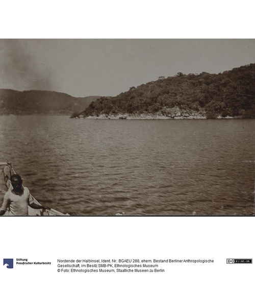
Nordende der Halbinsel

Contact Cite this page Data sheet (PDF) Calculate distance to your current location Archived versions Mark for comparison Graph view

Description

Zettel aufgeklebt: "Nordende der Halbinsel ca. 4 km südsüdwestlich von der Missionsstation Kala. Das anstehende Gestein ist ein stark Plagioklas - haltiger Qurazporphyr. Es zerfällt zu kantigen, von ebenen Flächen begrenzten Blöcken und Stücken und unterschiedet sich dadurch in charakteristischer Weise von dem weiter nördlich auftretenden Granit."

Angaben zur Herkunft:
Aufnahme: 22. April 1911
historische Bezeichnung: Deutsch-Ostafrika (Kolonie/"Schutzgebiet")
Tanganjikasee
Aufnahmeort: Kilängi (?) (Halbinsel)

Material/Technique

Im Album, Silbergelatineabzug

Measurements

Kartonformat (Foto): 31 x 25 cm; Bildformat (Foto): 8 x 11 cm

Map
Ethnological Museum of Berlin

Object from: Ethnological Museum of Berlin

The Ethnologisches Museum (Ethnological Museum) evolved from the collections of the royal cabinets of art and since its foundation in 1873 has become...

Contact the institution

[Last update: ]

Usage and citation

The textual information presented here is free for non-commercial usage if the source is named. (Creative Commons Lizenz 3.0, by-nc-sa) Please name as source not only the internet representation but also the name of the museum.
Rights for the images are shown below the large images (which are accessible by clicking on the smaller images). If nothing different is mentioned there the same regulation as for textual information applies.
Any commercial usage of text or image demands communication with the museum.